What’s new in the latest releases
WHAT’S NEW IN
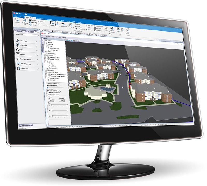
iBWAVE DESIGN ENTERPRISE
Uplink Capacity Module
Design uplink capacity right with our new module. Run automated Monte Carlo Simulations across multiple traffic/user scenarios to design quickly and precisely, with clear KPI pass/fail results for reliable SLA validation.
iBwave has a fresh new look
- Enjoy a modern, cleaner UI with updated controls, menus, icons, and part pictograms — making navigation more intuitive and efficient.
- Need more time to adjust? Easily switch back to the classic interface with a toggle.
Smart Door & Window Modeling
This release introduces Smart Door & Window Modeling. Simply select, modify, and place doors and windows directly on your floorplan from the toolbar, without the need for manual modeling. Placing multiple doors or windows? Just drop each one with a single click.
Zone – Sector – Remote Unit Mapping
Quickly determine how many Remote Units (Fiber BDAs and Media Converters) are needed to service each zone—per wireless service—based on Zone-to-Sector mapping.
WHAT’S NEW IN
iBWAVE DESIGN LITE
iBwave has a fresh new look
- Enjoy a modern, cleaner UI with updated controls, menus, icons, and part pictograms — making navigation more intuitive and efficient.
- Need more time to adjust? Easily switch back to the classic interface with a toggle.
Multi-Carrier Small Cell Signal Sources
- In the latest release, we've introduced support for OEM multi-carrier, multi-technology small cell signal sources. With these flexible signal sources, you can simplify your work and save time by deploying multiple services (technologies, bands, blocks, and channels) for multiple operators in a single OEM small cell signal source.
WHAT’S NEW IN
iBWAVE PRIVATE NETWORKS
(Private LTE/5G and Wi‑Fi)
Uplink Capacity Module
Design uplink capacity right with our new module. Run automated Monte Carlo Simulations across multiple traffic/user scenarios to design quickly and precisely, with clear KPI pass/fail results for reliable SLA validation.
iBwave has a fresh new look
- Enjoy a modern, cleaner UI with updated controls, menus, icons, and part pictograms — making navigation more intuitive and efficient.
- Need more time to adjust? Easily switch back to the classic interface with a toggle.
Smart Door & Window Modeling
This release introduces Smart Door & Window Modeling. Simply select, modify, and place doors and windows directly on your floorplan from the toolbar, without the need for manual modeling. Placing multiple doors or windows? Just drop each one with a single click.
Zone – Sector – Remote Unit Mapping
Quickly determine how many Remote Units (Fiber BDAs and Media Converters) are needed to service each zone—per wireless service—based on Zone-to-Sector mapping.
WHAT’S NEW IN
iBWAVE PRIVATE NETWORKS
(Wi‑Fi only solution)
iBwave has a fresh new look
- Enjoy a modern, cleaner UI with updated controls, menus, icons, and part pictograms — making navigation more intuitive and efficient.
- Need more time to adjust? Easily switch back to the classic interface with a toggle.
Smart Door & Window Modeling
This release introduces Smart Door & Window Modeling. Simply select, modify, and place doors and windows directly on your floorplan from the toolbar, without the need for manual modeling. Placing multiple doors or windows? Just drop each one with a single click.
Zone – Sector – Remote Unit Mapping
Quickly determine how many Remote Units (Fiber BDAs and Media Converters) are needed to service each zone—per wireless service—based on Zone-to-Sector mapping.
Wi-Fi 7 Support in iBwave
iBwave now supports Wi‑Fi 7 - 802.11be designs!
You can take advantage of all existing Wi‑Fi functionalities when designing for Wi‑Fi 7:
- Create 802.11be Wi‑Fi APs
- Auto Small Cell Placement
- Auto Channel Assignment
- All Output Maps
- Wi‑Fi 7 Survey Data Analysis
WHAT’S NEW IN
iBWAVE PUBLIC SAFETY
iBwave has a fresh new look
- Enjoy a modern, cleaner UI with updated controls, menus, icons, and part pictograms — making navigation more intuitive and efficient.
- Need more time to adjust? Easily switch back to the classic interface with a toggle.
Zone – Sector – Remote Unit Mapping
Quickly determine how many Remote Units (Fiber BDAs and Media Converters) are needed to service each zone—per wireless service—based on Zone-to-Sector mapping.
Smart Door & Window Modeling
This release introduces Smart Door & Window Modeling. Simply select, modify, and place doors and windows directly on your floorplan from the toolbar, without the need for manual modeling. Placing multiple doors or windows? Just drop each one with a single click.
WHAT’S NEW IN
iBWAVE REACH
View Imported Reach Prediction on the Outdoor Plan
- When importing iBwave Reach outdoor predictions into iBwave Design, you can now choose to include the imported predictions on the outdoor plan.
WHAT’S NEW IN
iBWAVE FIBERPASS
iBwave has a fresh new look
- Enjoy a modern, cleaner UI with updated controls, menus, icons, and part pictograms — making navigation more intuitive and efficient.
- Need more time to adjust? Easily switch back to the classic interface with a toggle.
Ultra-High Fiber Support
To better support ultra-high fiber components, fiber components now support higher port and strand limits. Parts now support up to 576 optical ports and up to 6912 fiber strands.
Added Stencils for Outdoor Modelling and Material Properties Enhancements
In the latest release, we’ve added new sample stencils for outdoor modeling, including vehicles, vegetation, and poles. Stencils now also retain all material RF and cosmetic properties and textures, so you don’t need to have the same materials in your components database to use them.
Global Stencil Library Privileges
Unity Administrators can now set access privileges for the Global Stencil Library. Users can be set with either no access, read-only access, or read-write access through the Unity admin tools.
WHAT’S NEW IN
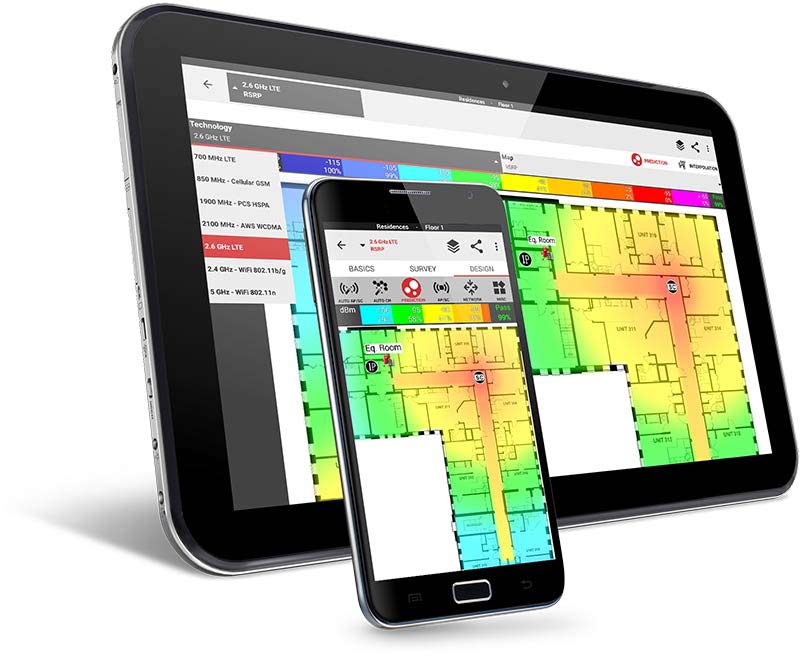
iBWAVE MOBILE PLANNER
Outdoor GPS Survey
We’ve added Outdoor GPS Survey Mode to iBwave Mobile, letting you perform hands-free outdoor surveys for P25, LTE, and 5G using any slow-moving vehicles such as golf carts, drones, and more! With GPS data collection and KML exports, you can export your survey measurements to Google Earth and GIS tools, streamlining your indoor and outdoor network surveys!
WHAT’S NEW IN
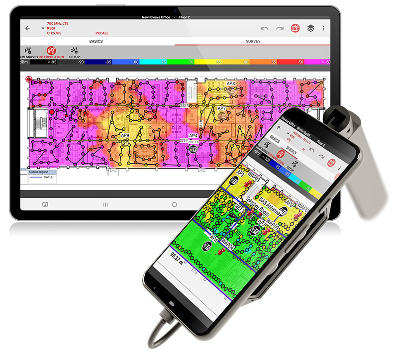
iBWAVE MOBILE SURVEY
Outdoor GPS Survey
We’ve added Outdoor GPS Survey Mode to iBwave Mobile, letting you perform hands-free outdoor surveys for P25, LTE, and 5G using any slow-moving vehicles such as golf carts, drones, and more! With GPS data collection and KML exports, you can export your survey measurements to Google Earth and GIS tools, streamlining your indoor and outdoor network surveys!
WHAT’S NEW IN
iBWAVE MOBILE SURVEY (for Public Safety)
Outdoor GPS Survey
We’ve added Outdoor GPS Survey Mode to iBwave Mobile, letting you perform hands-free outdoor surveys for P25, LTE, and 5G using any slow-moving vehicles like golf carts, drones, and more! With GPS data collection and KML exports, you can export your survey measurements to Google Earth and GIS tools, streamlining your indoor and outdoor network surveys!
WHAT’S NEW IN
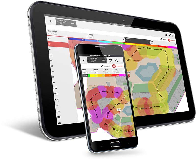
iBWAVE Wi‑Fi MOBILE
PDF Files Imports
- You can now import PDF files in Wi-Fi Mobile for floor plan, outdoor plan, picture plan, picture on a floorplan and pushpin attachment to further streamline your work with iBwave Wi-Fi Mobile.
WHAT’S NEW IN
iBWAVE FIBERPASS MOBILE
PDF Files Imports
- You can now import PDF files in FiberPass Mobile for floor plan, outdoor plan, picture plan, picture on a floorplan and pushpin attachment to further streamline your work with iBwave FiberPass Mobile.
WHAT’S NEW IN
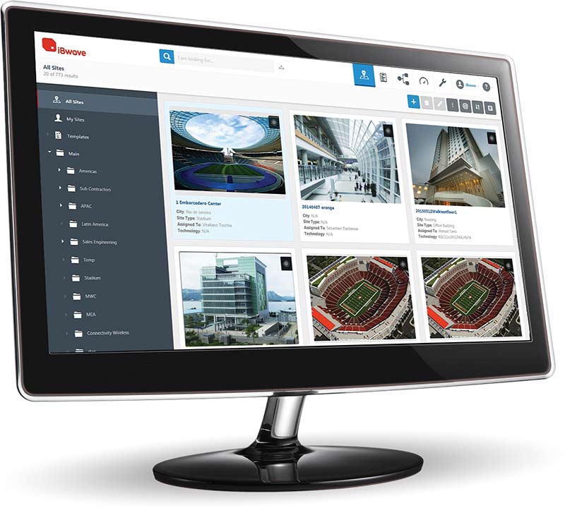
iBWAVE UNITY
New iBwave Unity is Here! Now in the Cloud and with New Features.
You can now leverage new features that significantly improves your existing solutions, including iBwave Design & iBwave Mobile. Save time, increase efficiency and elevate wireless management with the power of Digital Twins.
- Streamline Workflows with Custom Templates
Set up survey and design projects just once with advanced and customizable templates. Leverage intelligent data and automation to save up to 6 hours per project! - Accelerate Your Wireless Survey Proces
Prepopulate survey sites directly from iBwave Unity, saving setup time. Use customizable checklists to ensure complete, consistent data capture and minimize rework.
- Simplify Reporting for Smarter Decisions
Ditch multiple platforms with static data. Keep teams and stakeholders informed through customizable, up-to-date reports that are easy to create and share and always accurate. - Elevate Wireless Management with Digital Twins
Visualize and manage your projects through digital twins—interactive replicas of your buildings. Track technologies, monitor changes, and collaborate effortlessly, all in one place.